


This weekend saw 4 of us try a Kenny Wilson route we’d never done before – what could possibly go wrong…….?
So, there I am, 10:20 Sunday morning, driving along the M80 towards Stirling. I’m looking straight at the Ochils. Or at least, I’m looking straight at where the Ochils should be. Except all I can see is a big bank of low cloud clinging to the hills and I’m thinking to myself:
“I’ve never actually done this ride before. The route heads out across open hills. The trail is practically invisible in places and we’ll have very poor visibility up there. Is this really such a good idea? Hmm. I’ll meet up with folks in Dollar and if we decide it’s game over we can go and check out Dumyat – at least I know the route up there!”
At this point I was glad of spending a few quid on the 25K Explorer map and packing my compass – and my navigation skills training? Oh, that will all come back to me once I’m up there, it’ll be fine. Arriving at Dollar the weather was an odd mix of sometimes warm, sometimes cool, mainly cloudy, the odd spot of rain and the odd glimpse of sunshine. I’ve no idea what weather icon this translates as.
Out for this potential adventure/disaster (delete as applicable) was Mountain Marathon-ist Liz, IronWoman-ist Dawn, rigid singlespeed-ist Jack and big full-suss, knee pads, first aid kit and map & compass-ist me. Baden Powell’s words “Be prepared!” were ringing loud in my ears. We decided that we’d give it a go so we headed off in the direction of Tilly & Alva via the cycle path – yeah, full suss and kneepads on a cycle path! Totally overbiked!
We found the woodland climb out of Tilly and into Alva and set off in good spirits up the crazy-steep zig zags of Silver Glen. Jack was giving it his best shot but the gearing on the singlespeed would’ve needed Bradley Wiggin’s legs to get anywhere. Climbing up the glen we had some hot sunshine and passed a few cheerful walkers. For the most part the trails had been fireroad until we reached the end of the glen below Ben Buck.
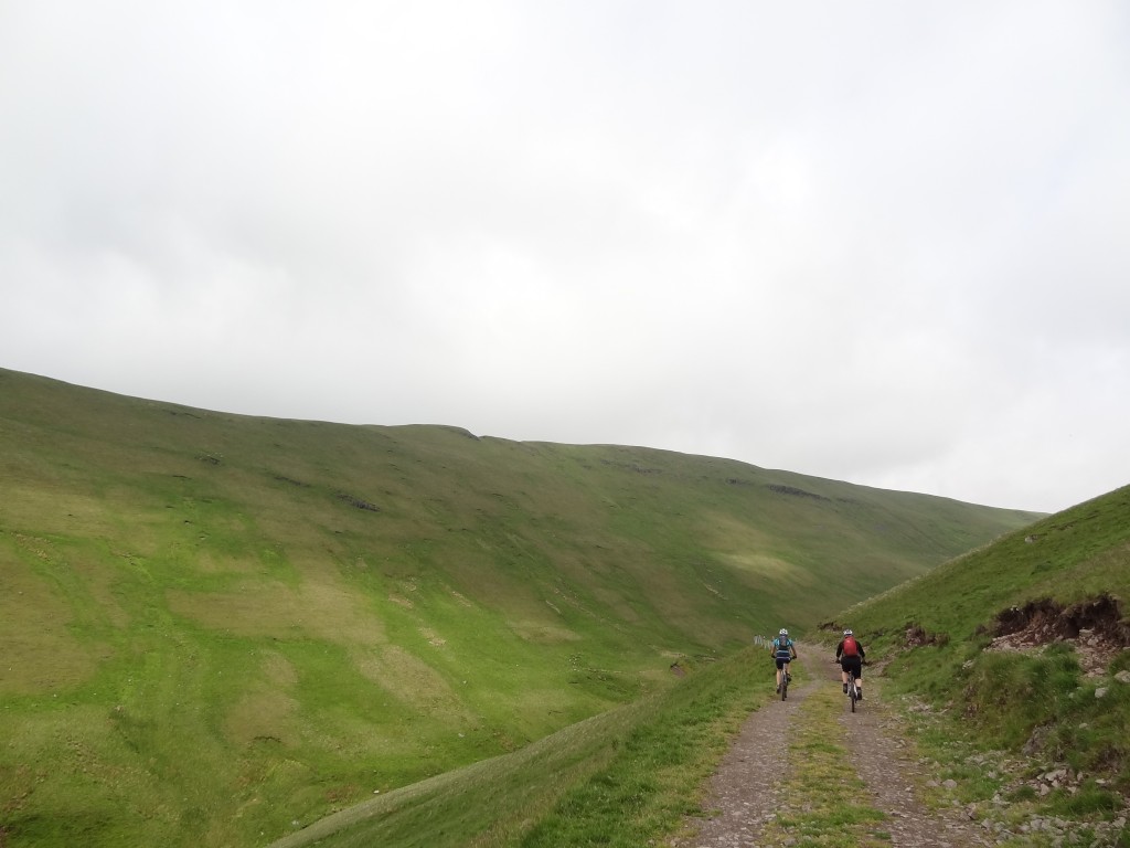
Ochils Climb (the flat bit!)
Now the fun began. We had to pick up a vague path leading to the summit and start to follow fence lines into the mist, with the summit of Ben Cleuch disappearing and re-appearing in the mist as it rolled over the hills. By this point it was cold too so stopping for long was not a good idea. So far the fence lines on the map matched up with reality and we’d managed to make our way to the summit of Andrew Gannel Hill. After this it all started to go a bit downhill, literally.
We’d followed an obvious trail down towards the east and when stopping to check our route we met 2 walkers who assured us it flattened out and we (I?) assumed this was the next check point of Maddy Moss. NB: the trail down had been pretty good fun after all the climbing; soft in places, nice and natural, some little drops, quite flowy – and more to come! At the bottom though, the map reading/navigating was a bit, errr, wishful and the terrain a bit indistinct and we started off not 100% sure that we were going the right way. Once Liz had grabbed the compass and pointed out that we were heading east towards the Glen Of Sorrow (how apt this was starting to feel!) instead of north towards the Glen Devon reservoirs it all started to become a bit of a wander in the hills rather than a bike ride.
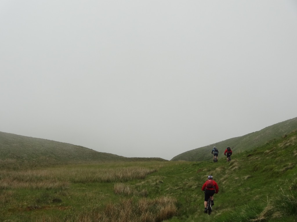
Bikers In The Mist
We were conscious that time was ticking and the best plan was to pick up the fence lines that we’d lost sight of following our descent. Under Liz’s leadership, some proper heather bashing up and down the hills got us back to a recognisable fence junction only to find that the path showing on the map was actually just a tussocky hill. Oh tussocks!!
So. It was decision time. Surprising us all, 2 and a half hours had passed since we’d left the fireroad, it was 3:30pm and we were still heading out and facing more than half of the route. The options were:
- Option 1: Carry on with the route and consider a bail out with a 10mile road ride
- Option 2: Call it a day & retrace our steps to Ben Cleuch and back down the fireroad, or
- Option 3: Call it a day & get back to a previous path junction and follow an enticing piece of singletrack on a path we were 99% sure we knew where it went.
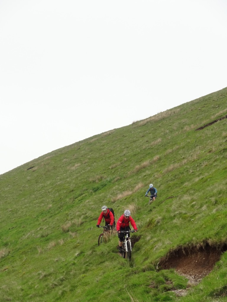
Option 3 won the vote – with a collective sigh of relief. A bit more heather bashing got us back to our previous downhill run and spat us out on what turned out to be the highlight of the day – a lovely, flowing, rutted piece of singletrack that contoured its way along a peaceful, steep-sided river valley. The way the trail undulated, twisted and turned meant you had to keep your wits about you to avoid scrubbing the side of the deep rutted path. It didn’t really lose a lot of height and I got the feeling you could ride it without pedalling, just pumping the bike along the undulations.
Swoopy Trails
We stopped occasionally to regroup and savour the trail and share thoughts of making it to the Chippy of Happiness in Bridge of Allan and not dying of exposure in the Glen of Sorrow. (warning, slight exaggeration may be present here). The trail finally started to steepen up, quite dramatically too, as we were pitched down into Tilly, behind the old quarry and were finally treated to some decent views out over the Forth valley.
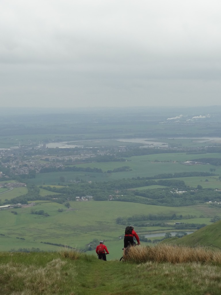
Ochils Descent
From here on in, every pedal stroke took us closer to Dollar and a swift change of clothes before high tailing it to the chippy to do a post-mortem of the ride over a fish supper and delicious ice cream (comfort food!).
So, what did we get out of the ride? A good climb, a good descent (eventually) and a reminder that you really do need to have a map and compass as well as the knowledge to use them when you’re out in the hills – and doing a course is not enough, you really need to practice your map reading too! Thanks to Liz, Jack and Dawn for sticking with it – and we’ll have a re-match with the Glen Devon route on a sunnier day (but I’ll still be packing the map and compass!).
Photos here.


Nice write-up Graham. The narrow, deep singletarck descent which then drops down steeply into Tillicoultry is the same descent that we used to do on the old GMBC Ochils ride. We used to do this ride maybe twice a year but the last time it was ridden was in 2005 and that was only four of us. It was probably the toughest of the old GMBC Sunday run routes as it had lots of climbing, but also some crackin long descents. Nothing particularly techy, but all rideable and a lovely, old fashioned Scottish day ride in the hills. I have good memories of a dozen or so of us riding it on sunny days (and also a memory of one of my very first Sunday runs in the winter of 88/89 on a very wet day with the two fittest riders in the club…)
I intend to go back and do it again this summer if you’re interested? The route is: park in Tillocoultry; road to Dollar; Dollar Glen past Castle Campbell; Glenquey reservoir; Glendevon; Borland Glen to Coulshill Farm; minor tarmac road (great descent) to A823 Glen Eagles road; track south up Glen Eagles; west to Glendevon reservoirs; path south over Andrew Gannel Hill; then same descent you did down Mill Glen to Tillicoultry.
Never done it, but I do remember tales about bad weather up there, maybe that’s why it hasn’t been on the calender for so long. Put me down for the rematch
Hi Pete – sounds like a grand day out in the hills. Keep me posted with your plans, would prefer if it’s better weather than our trip on Sunday though.
Done this with sanny about four years ago then dumyat same day was a good day out